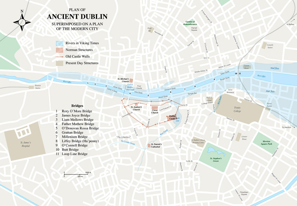
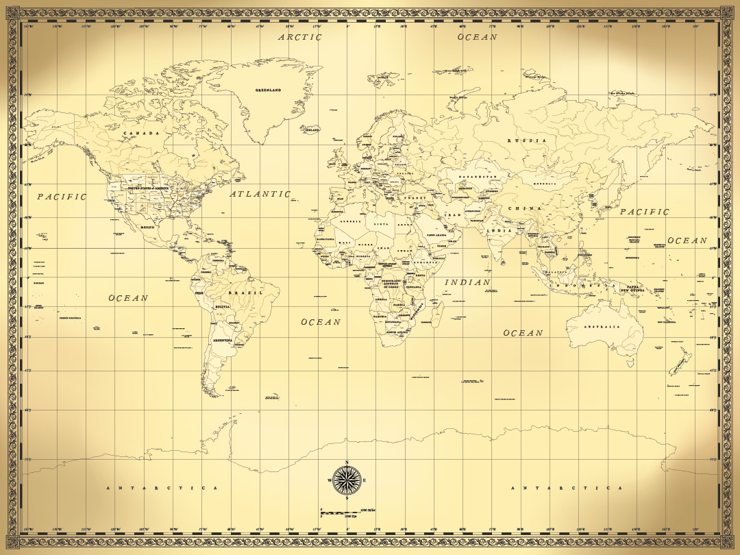
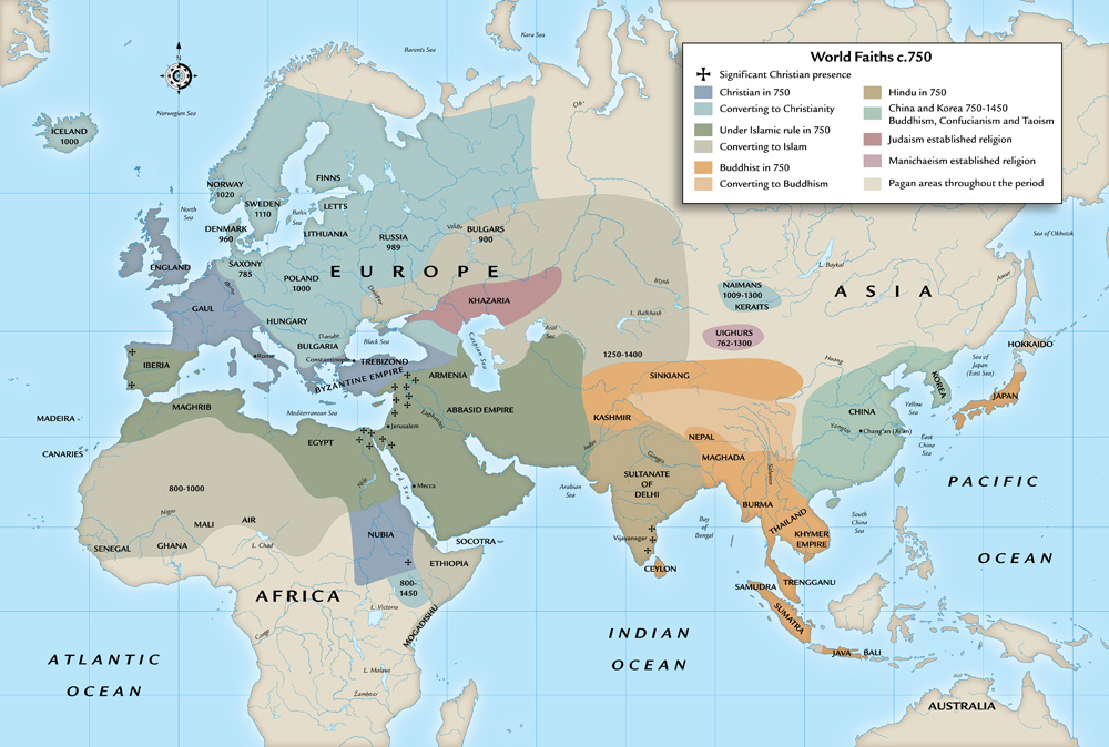
Mark Franklin Arts
Mark Franklin Arts
  • Portfolio
    • Architecture & BuildingTechnical illustrations of buildings and architectural subjects.
    • Automotive & TransportTechnical illustrations and cutaway drawings of transport related subjects, including cars, motorcycles, commercial vehicles, trains, ships and boats
    • Civil Aviation & AerospaceTechnical illustrations and cutaway drawings of civil aircraft and helicopters, spacecraft, aerospace and aviation subjects.
    • Diagrams & Information GraphicsTechnical illustrations of a variety of subjects in diagrammatic style, line and colour, information graphics, instructional and educational illustration, charts and graphs.
    • Science, Technology & EngineeringTechnical illustrations and cutaway drawings of scientific, technical and engineering subjects.
    • Cutaways & Exploded ViewsTechnical illustrations, cutaway drawings and exploded views of a variety of subjects
    • Line DrawingsTechnical illustrations as simple black and white line drawings.
    • MapsMaps of cities, countries and regions. Route maps, historical and battle maps, illustrated maps.
    • Weapons & WarTechnical illustrations, cutaway drawings and exploded views of military subjects. Guns, firearms, small arms and infantry support weapons; artillery, missiles and ordnance; swords and edged weapons; tactical and strategic weapons; military insignia, badges and medals; battle maps and tactical diagrams.
    • Other WorkRealistic and technical illustration, digital retouching and photo manipulation, cardboard engineered models.

Maps

Maps of cities, countries and regions. Route maps, historical and battle maps, illustrated maps.

Maps

Country Maps

  Three of the 120 country maps produced for Australia’s Navgu Travel Publishing.

By Mark Franklin, 10 years ago
Maps

Dragon’s Back

  One of about 40 maps for Ian Corless’s “Running Beyond: The Greatest Ultrarunners and their Races”, published by Aurum Press.

By Mark Franklin, 10 years ago
Diagrams & Information Graphics

Amstel Gold Cycle Race

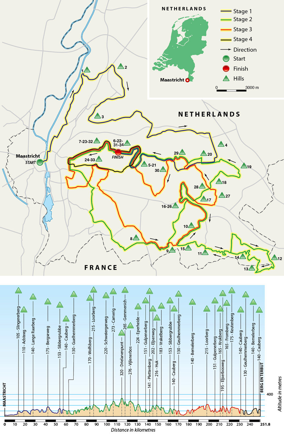
One of 25 sets of route maps and race profiles for Peter Cossins’s “Ultimate Etapes: Ride Europe’s Greatest Cycling Stages”, published by Aurum Press.

By Mark Franklin, 10 years ago
Maps

Leighton Buzzard

Illustrated maps for Leighton-Linslade Town Council The town centre Linslade Recreation Ground Page’s Park Vandyke Road Cemetery

By Mark Franklin, 11 years5th September 2015 ago
Maps

Antique Map

By Mark Franklin, 11 years ago
Maps

North American Tribes

By Mark Franklin, 11 years ago
Maps

Ancient Dublin

A map of ancient Dublin superimposed on the modern city.

By Mark Franklin, 11 years ago
Maps

World Faiths

By Mark Franklin, 11 years ago

Posts pagination

1 2 3 Next

Hestia | Developed by ThemeIsle